The Nile River is not just a natural watercourse, it is the backbone of Egypt both geographically and culturally. It has been the mythical place that inspired the ancient religion and serves as a source of life and wealth for the inhabitants of this country due to its agricultural possibilities.
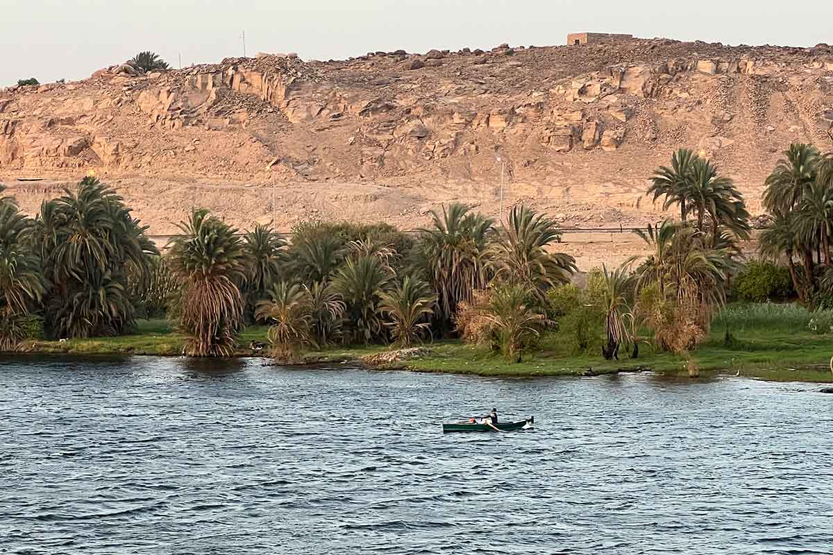
Today, the Nile River is also a major tourist attraction with organized cruises along its course, particularly in Upper Egypt. Our agency offers traditional vessels and motorboats for these cruises. Given its importance to the life, culture, and economy of the country, we dedicate this page to provide you with all the interesting facts and peculiarities of this magnificent river.
Before exploring the importance of the Nile River for Egypt, let’s take a quick look at its main facts:

Although only its final part runs through Egypt, the Nile River is a significant presence in the country, covering over 1,500 km in a south-north direction. This stretch can be further divided into two distinct regions:
The mere presence of the Nile River was not what made the emergence and development of Ancient Egypt possible, one of the most advanced civilizations of its time. What truly made their economy and way of life sustainable were the floods of the river. This was a natural phenomenon that occurred annually and involved the water level of the Nile rising and flooding the banks on either side of the river.
The reason for these floods of the Nile River must be sought thousands of kilometers to the south, in the upper reaches of this great river. Specifically, in the Blue Nile, one of the two branches that feed its flow from the Middle Nile onwards. The Ethiopian Highlands, where this branch originates, experiences an intense wet season between May and August, when heavy monsoon rains are unleashed. This, combined with the flood of the Sobat River in the White Nile, causes a significant increase in flow that gradually moves north, surpassing the six cataracts and reaching Egypt from June-July onwards.
Therefore, the annual cycle of the Nile River was, according to its rhythm of floods:
The Nile River’s annual flood cycle was not always consistent, as there could be climatic variations that affected the monsoon rains in the Ethiopian Highlands, ultimately disrupting the Egyptian agricultural system. Excessive flooding or insufficient flooding could be the result of these variations. Additionally, the extent and timing of floods varied depending on the geographic location. To predict the annual flood levels, constructions such as the Nilometer were built and are now visitable in Cairo. There are noticeable differences between the flood levels in Aswan, which marks the end of the Middle Nile and southern Egypt, and Cairo, which is the most advanced location before the formation of the Delta. The following are the usual estimates:
In the mid-twentieth century, the Nile River floods ceased to occur due to the construction of the large Aswan Dam during the tenure of Gamal Abdel Nasser. The dam was built to control the river’s flow as it enters the country further south of Aswan, giving rise to Lake Nasser, which extends for approximately 550 km and has a variable width that reaches up to 35 km.
This mega-project had a significant impact on the natural environment, economy, society, and culture. The Nubian community located in southern Egypt was displaced due to the flooding of their villages.
Stone by stone, temples and monuments of Ancient Egypt located in the area were dismantled and moved to higher elevations to prevent their ruin. Abu Simbel is the most famous of all, but there were others as well. This task required international assistance, and as a sign of gratitude, the Egyptian government gave temples to the main collaborators. Spain was one of them, receiving as a gift the Temple of Debod, now in a park in Madrid.
Currently, the course of the Nile River is constant and not subject to significant seasonal variations since the Aswan Dam regulates it. This control of the river flow also allows boat transportation between the cities of Aswan and Wadi Halfa on Lake Nasser. Above all, it allows for tourist cruises throughout Upper Egypt, which our agency organizes to measure.
The Nile River was not only crucial for the Ancient Egyptians’ economy and way of life but also had a deep religious significance. The annual flooding of the Nile River was a natural phenomenon that lacked a scientific explanation, leading the Ancient Egyptians to turn to religion to understand it.
Egyptian mythology provided several explanations for the floods, with Hapi and Isis being the most prominent gods associated with it. Hapi was believed to live in a cave near the Nile River falls and emerged every year to cause the flooding of the waters. On the other hand, the tears of Isis for her husband and brother Osiris’ death triggered the flood. This divine flood was considered sacred and celebrated with a religious festival that lasted for several weeks.
Apart from the myth and festival, the Nile’s annual flooding influenced the Egyptians’ worldview and their explanation of the universe’s origin (cosmogonies). According to different theories (Heliopolis, Hermopolis, and Memphis), the origin of everything was in the primordial waters from which the creator gods emerged. The Nile River’s withdrawal, which led to the emergence or germination of the rest of the elements, may have inspired this belief.
The Nile River has been and continues to be a significant economic driver in Egypt, with much of the country’s economic activity centered around it. During Ancient Egypt, the Nile’s floods were a fascinating natural phenomenon that spurred ingenuity and engineering, driving the development of irrigation and canalization systems to take advantage of the water flow and silt transport that contributed to soil fertility.
El Fayum provides an excellent example of this, as irrigation projects were implemented as early as the Middle Kingdom. This importance continued throughout the ages, even after the Muslim conquest, as demonstrated by the successive irrigation improvement projects, in which the Arabs excelled. One notable example is Saladino, who renewed the Joseph Canal or Bahr Yussef in El Fayum in the 12th century.
Despite the mastery of irrigation techniques, the Nile River’s variations could still cause periods of poor harvests, famine, and social instability, as seen during the time of the Fatimid caliph Al-Mustansir in the mid-11th century, exacerbated by military conflicts with Turks and Berbers.
Although industrial advances emerged in the 19th century, diversifying the Egyptian economy and improving irrigation techniques, the Nile River still plays a significant role in the country’s economy. The majority of the Egyptian population lives on the banks or in the delta of the Nile, and crops grown along its banks still represent over 10% of the country’s GDP.
Furthermore, the Nile is a significant economic driver for tourism, as it is one of the major attractions for visitors to the country. Cruising on the Nile River allows tourists to witness its natural beauty and explore its historical and artistic treasures, all while enjoying the comfort of boats sailing on its waters. On this page, you can learn more about the unforgettable cruise experiences we offer, whether on traditional boats or motor ships.
Fill out the form below to receive a free, no-obligation, tailor-made quote from an agency specialized in Egypt.
Travel agency and DMC specializing in private and tailor-made trips to Egypt.
Mandala Tours, S.L, NIF: B51037471
License: C.I.AN-187782-3